OpenDroneMap and WebODM are separate projects as of 2026.
Do not assume WebODM's interface, plans, processing engines, or support arrangements are part of the OpenDroneMap toolkit.
Evidence source ↗
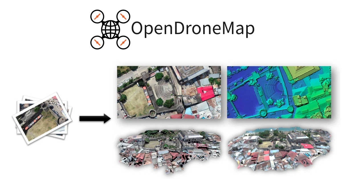
OpenDroneMap is an open-source command-line toolkit that converts aerial images into georeferenced maps, elevation models, point clouds, and textured 3D models.
Official documentation describes diverse geospatial outputs, configurable processing, local deployment, and NodeODM API access. The core toolkit is free and open source, but command-line setup and substantial hardware needs can burden some users. No verified third-party ratings or review themes were found.
This profile combines documented product information and independent evidence where available. It is not a hands-on test unless TechZella explicitly identifies one.
OpenDroneMap (ODM) is an open-source command-line toolkit for processing aerial images into geospatial outputs. Its documented outputs include orthophotos, digital elevation models, classified point clouds, and textured 3D models.
Users can run ODM locally through Docker or install it natively on Windows. The core toolkit is free; a separately sold installer simplifies setup and includes installation support. Processing is hardware-intensive, especially for larger image collections.
A quick way to understand who this product may suit, where its limits matter, and which facts are most relevant before you compare alternatives.
Researchers, educators, and technical teams that need locally processed aerial imagery converted into georeferenced maps, elevation data, point clouds, or 3D models.
Users seeking a fully managed cloud service or a simple graphical workflow may prefer a separately evaluated product. OpenDroneMap's core interface is command-line oriented, and large projects require substantial local memory and storage, and should evaluate alternatives such as PIX4Dmapper or Agisoft Metashape instead.
CLI, Docker, Linux, macOS, Windows
7.2/10
These are the product-specific differences that may matter when deciding whether the software fits your workflow. They are based on documented evidence rather than a universal ranking.
These are documented constraints or practical friction points that may matter before you adopt the product.
Do not assume WebODM's interface, plans, processing engines, or support arrangements are part of the OpenDroneMap toolkit.
Evidence source ↗The documentation warns that the minimum configuration may run out of memory beyond roughly 100 to 200 images.
Evidence source ↗The installer page instead advertises a 30-day money-back guarantee; the open-source toolkit remains separately available.
Evidence source ↗The core command-line toolkit is free and open source. Self-installation and local hardware are the user's responsibility.
Check current pricing →Includes the OpenDroneMap Installer, one year of installation support, per-user licensing, and updates.
Check current pricing →Includes the OpenDroneMap Installer, one year of priority installation support, per-user licensing, and updates.
Check current pricing →Pricing may change. Verify current plans on the vendor's website.
Compare similar products directly, then see which alternatives may make more sense when your requirements differ.
| Decision factor | OpenDroneMap | PIX4Dmapper | Agisoft Metashape |
|---|---|---|---|
| Processing model | Local command-line processing, with Docker and native Windows options. | Desktop processing with unlimited desktop processing and high-resolution outputs under its subscription. Source ↗ | A standalone photogrammetry application with separate cloud processing options. Source ↗ |
| Pricing model | Open-source toolkit is free; optional installers cost $64 or $149 as one-time purchases. | PIX4Dmapper is a recurring subscription listed at $332.50 per month or $3,990 billed yearly. Source ↗ | Agisoft describes its standard Metashape licenses as not time-limited; current standard commercial pricing was not verified on the pages checked. Source ↗ |
| Output formats | Produces orthophotos, elevation models, point clouds, and textured 3D models. | Lists orthomosaics, digital surface models, point clouds, and 3D textured meshes among its outputs. Source ↗ | Lists orthomosaics, DSM/DTM products, dense point clouds, and textured 3D models among its outputs. Source ↗ |
Only factors supported by the available research are shown. The comparison is descriptive, not a ranking.
These products address broadly similar requirements. The descriptions focus on documented reasons a buyer might compare them with OpenDroneMap.
| License | AGPL-3.0-only |
|---|---|
| Processing interface | Command line |
| Deployment | Local installation or Docker |
| API | NodeODM API |
| Minimum documented memory | 4 GB RAM |
| Recommended memory | 16 GB RAM for a few hundred images |
| Minimum documented disk space | 20 GB |
| Documented output formats | GeoTIFF, LAZ, OBJ, PLY, among others |
Verified installation, hosting, administration, or environment details that can affect implementation.
| Installation or hosting | Run the open-source toolkit locally through Docker or a native Windows installer. The paid installer automates dependency installation and includes installation support. Source ↗ |
|---|---|
| Processing location | The documented ODM workflow processes project imagery on the machine or environment where it is installed; NodeODM can expose processing over a network. Source ↗ |
Documented portability, standards, export, or switching considerations. No switching-cost score is shown unless the evidence supports one.
Documented outputs include GeoTIFF orthophotos, georeferenced elevation products, point-cloud formats, and textured 3D model files, which can be opened in external GIS and 3D tools.
Evidence source ↗A proprietary editorial score based on product capabilities, usability, value, performance, support and user sentiment evidence.
Official documentation describes diverse geospatial outputs, configurable processing, local deployment, and NodeODM API access. The core toolkit is free and open source, but command-line setup and substantial hardware needs can burden some users. No verified third-party ratings or review themes were found.
Methodology v1.0. The assessment weighs feature coverage (25%), ease of use (15%), value for money (20%), performance (15%), support (10%) and user sentiment (15%), using researched product evidence and verified review evidence where available. It is a TechZella editorial assessment, not a direct user-review average.
Key claims are linked to the sources used to verify them. This evidence record is separate from third-party user ratings.
TechZella evaluates software using documented product capabilities, pricing information, usability and value considerations, independent user evidence where available, and competitive context. The assessment is an editorial review, not a hands-on test unless one is explicitly identified. Our editorial assessment is based on 4 documented sources.
The project repository describes these output types for the command-line toolkit.
View source ↗Verified 2026-11-10The project README documents Docker commands for Windows and Mac/Linux and a native Windows setup.
View source ↗Verified 2026-11-10The official NodeODM page identifies its API specification, reference implementation, and API clients.
View source ↗Verified 2026-11-10The installer page lists both prices, installation support, updates, and a 30-day money-back guarantee.
View source ↗Verified 2026-11-10The installer FAQ states that installer trials are unavailable and separately lists a 30-day money-back guarantee.
View source ↗Verified 2026-11-10The installation documentation lists minimum CPU, disk, and memory requirements and describes the associated image-count limitation.
View source ↗Verified 2026-11-10Answers begin with the clearest available response, followed by the context that helps you act on it.
No reviews yet. Be the first to share your experience.
Please log in to submit a review.